
Carmel ZIP Code Coverage
Official Town and USPS material verifies two postal labels that matter most for Town of Carmel research. They are delivery slices, not separate governments or a complete map of the town. The county seat and County Office Building use the Carmel label, while Town Hall uses the Mahopac label. Keep the ZIP code, postal city, municipality, and parcel identifier as separate facts when saving a record.
| ZIP | Areas Covered | Post Office | Notes |
|---|---|---|---|
| 10512 | Carmel and surrounding Town of Carmel addresses using the Carmel postal label, including the Carmel hamlet and nearby county-seat area | Carmel Post Office / Carmel, NY | The ZIP label does not establish that every address is inside the legal town. Verify parcel and municipality. |
| 10541 | Mahopac, Mahopac Falls, and much of the Town of Carmel using the Mahopac postal label | Mahopac Post Office / Mahopac, NY | Town Hall uses 10541. “Mahopac” is not a separate legal town boundary for every address. |
No additional unique, PO-box-only, or single-institution ZIP serving the town was located in the official material inspected. The absence is a research gap, not proof that no special-use label exists. Confirm a disputed address with USPS or the appropriate post office before treating these two rows as exhaustive.
Carmel ZIP Labels
The Town of Carmel is the legal geography within Putnam County. Postal geography is different. The USPS label list identifies 10512 as Carmel and 10541 as Mahopac, yet an address with a Mahopac mailing city can still be in the Town of Carmel. The contrast is visible in official addresses: Town Hall is at 60 McAlpin Avenue, Mahopac, NY 10541, while the County Office Building is at 40 Gleneida Avenue, Carmel, NY 10512.
That is why a mailing city should never replace the municipality in a record search. School, fire, EMS, water, election, and parcel districts also do not necessarily follow the postal label. Use the delivery ZIP for mail verification, then use a parcel, tax map, or dated district layer for the jurisdiction that controls the record.
Carmel was created in 1795, and later boundary changes affected nearby geography, but no official ZIP-boundary-change notice was located. Historical material may describe a hamlet, lake, route, station, or farm instead of a current mailing city. Read the source year with the place label, especially when a postal form appears to conflict with a modern municipal record.
Boundary check. A ZIP code is delivery geography, not an incorporated-place boundary. For a 10541 street, search both the Mahopac postal form and the Town of Carmel municipality. For a 10512 address, confirm the parcel rather than assuming the Carmel label resolves the town line.
Verify Carmel ZIP Labels
The address-level result is the right starting point when the street number and delivery label are in doubt. It does not establish ownership, occupancy, voting status, or a district. It simply confirms how USPS recognizes the submitted address for delivery. Preserve the result date because delivery labels can change independently of the tax roll or a deed.
Use the USPS ZIP Code Lookup to enter one complete address and confirm its ZIP and mailing city.
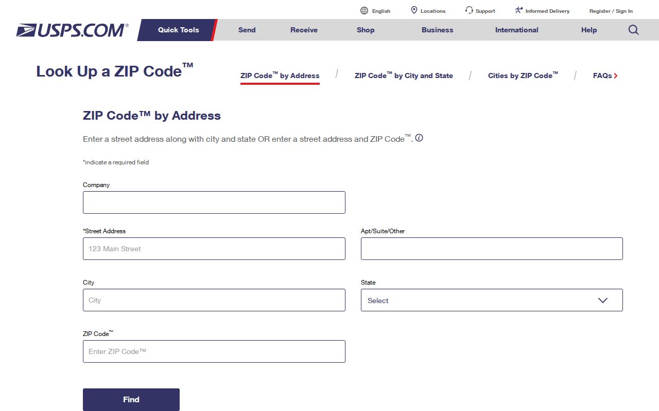
After USPS returns a delivery label, compare that label with the property address and tax map used by local records. A match makes the next search cleaner; it does not turn a ZIP result into a municipal-boundary finding.
ZIP Code Fields in Carmel
The official New York voter lookup includes ZIP Code, but it is a person’s registration-status and polling-place self-check. It is not a ZIP-wide roster. The county property help and Town tax portal document other fields instead. Their records should be searched with the stable parcel, bill, owner, or address information they actually accept.
| Field | Where It Appears | How It Is Used |
|---|---|---|
| County | New York voter lookup | Required before a self-check can be run. |
| Last Name | New York voter lookup | Required identifying field for the individual check. |
| First Name | New York voter lookup | Required identifying field for the individual check. |
| DOB | New York voter lookup | Required in MM/DD/YYYY format. |
| ZIP | New York voter lookup | Required with the address information; not a public block-search filter. |
| Address | New York voter lookup | Required address information; the visible text inspection did not expose every subfield. |
The Carmel tax portal documents Bill #, Tax Map #, and Property Address, with street suffixes omitted for its property-address search. The county help lists Property ID, Owner Name, Property Address, and Billing Address. It does not document a ZIP filter, and the GIS material did not expose a verified ZIP search control.
When a property identifier is known, the county help treats it as the preferred search key and documents exact, comma-separated, and wildcard patterns such as *1234*, 1234*, and *1234. Owner searches can use “Last Name, First Name,” “Last Name, First Initial,” or a last name alone. Property and billing-address searches can use partial or wildcard forms. Those are property-search functions, not evidence that the portal accepts a ZIP-wide search.
Trace Carmel ZIP Addresses
A ZIP result is most useful as the first link in a dated record trail. The sequence below keeps delivery geography from being mistaken for a person or parcel result. Each source answers a narrower question than the one before it.
- Verify the exact mailing label with USPS using the complete street address.
- Search the Carmel tax portal by bill number, tax map number, or property address, or use the county property search with its documented fields.
- Open Putnam County GIS with the tax ID or parcel result, then read the municipality, acreage, address, map date, and active layers.
- Use the county roll or County Clerk index for the dated parcel and legal-record trail. Search alternate postal forms if the first address does not return a result.
- For a historical hit, record the source year and printed place name before comparing directories, maps, or newspapers.
The county property search limits results to 400, so broad owner or street queries need narrowing. Once a road is known, the Carmel street directory provides the address-by-address record chain. A ZIP-only result cannot confirm that a person lives at an address.
If a portal returns no result, check the spelling and suffix rules, try the alternate Carmel or Mahopac postal form, then compare the date range and the custodian’s separate index. Save the source title, URL, record year or date, retrieval date, and any instrument or tax-map number. A missing online result may reflect an unindexed record, a format difference, redaction, or a research gap.
Carmel ZIP Parcel Records
Tax and GIS systems are parcel-centered. The situs, or property location, identifies the parcel. A tax bill can also show a mailing address, which identifies where the notice was sent. County deeds rely on a legal description, grantor or grantee name, and recording reference. A street number may be absent from an older deed or historical map.
These are different address roles. A voter record uses a residence address and election district subject to confidentiality. A historical directory uses the postal or community wording printed in that source. A business entry can use a service or principal-business address. Keep the date beside each form, because a ZIP search can find a mailing label while missing the parcel that holds the legal record.
- Situs address
- The property location connected to a parcel and tax map.
- Mailing address
- The address printed for tax correspondence. It may differ from the property location.
- Legal description
- The parcel or lot description used in recorded land instruments, sometimes instead of a street number.
Carmel ZIP District Overlays
Putnam County GIS documents parcel, address, road, aerial, hydrography, fire, EMS, school, township, village, and voter-precinct layers. The official Carmel map shows Election Districts 1 through 30, major roads, lakes, and town geography. A district number must carry an election year or map date because boundaries and polling information can change.
Lake Mahopac, Lake Gleneida, Lake Gilead, and Croton Falls Reservoir are useful map context, but a water feature or ZIP label does not establish a public-record jurisdiction. Select the actual layer and date when comparing an address to a school, fire, EMS, or election boundary.
Limits of Carmel ZIP Labels
No official ZIP split, realignment history, ZIP-level registration statistics, or ZIP-level population table specific to Carmel was located. Census QuickFacts is town-level, while Board of Elections information is district- and election-year based. Treat an empty ZIP search as a prompt to check spelling, postal city, date range, parcel ID, or the correct custodian, not as proof that the address has no record.
Older Carmel entries can also use a hamlet, route, lake, farm, station, or another postal wording rather than a current number. No verified local street-renumbering bridge table was located. Compare the tax map, legal description, road or hamlet name, historic map, deed, and current GIS before matching old and current addresses.
When an online route stops, describe the record narrowly for the correct custodian. A County Clerk FOIL request asks for the county department, a specific record description, electronic format choice, and requester contact details. For a tax-roll record, request the official roll year, page, and tax-map row. Preserve a denial, redaction, delay, fee notice, or access gap rather than substituting an unofficial claim.
- ZIP code vs ZIP+4
- A ZIP code is a five-digit USPS delivery geography. ZIP+4 adds four digits to sort mail more precisely within that delivery area; neither form defines the Town of Carmel boundary.
- PO-box ZIP
- A ZIP assigned for post-office boxes. No such Carmel-serving label was verified in the inspected official sources.
- Unique ZIP
- A ZIP assigned to a single institution or large recipient. None serving the town was verified in the inspected official sources.
- Carrier route
- A postal delivery sequence within an area. It is a mail-routing unit, not a town or parcel boundary.