
Work a Carmel Street Directory Search
Use one address form at a time. Carmel tax and parcel records are most useful when they are tied to a tax map or a property location, while a recorded deed supplies the legal description that persists when a street number or postal label changes. The public voter self-lookup is not a street browse. It is a limited registration and polling-place check for a person using required identifying fields. Historical printed sources can add a dated household or business connection, but they should never be presented as current evidence. The sequence below keeps those roles separate.
- Enter the address or tax-map reference in the Carmel tax search and save the bill year, property location, owner as printed, and map number.
- Use the parcel reference in the county GIS resources. Confirm the municipality, acreage, address, map date, and the layers that are switched on.
- Return to the county tax roll for the dated owner, mailing address, property class, school district, assessment, and exemptions.
- Search the owner and legal description through the County Clerk land-record route. Read the recorded grantor, grantee, instrument date, and map reference before assuming a connection.
- Use election material only through the lawful self-check or a properly limited Board of Elections request, then ask local repositories about dated reverse or criss-cross sources.
For a road that appears under Mahopac in one record and Carmel in another, preserve both the postal label and the legal municipality. They are not interchangeable search fields.
Carmel Street Directory Tax Fields
The town and county searches use different field rules. The town portal is the direct route for a current bill tied to one address, map number, or bill number. The older county help page is useful when an address needs a partial search, a billing address, or a known owner name. Its documented result cap matters on a long road: narrow the query by a stable parcel or address detail instead of treating a broad result set as a complete street list.
| Search route | Field | How to enter it | Documented note |
|---|---|---|---|
| Carmel tax search | Bill # | Bill number | Omit leading zeroes. |
| Carmel tax search | Tax Map # | Tax-map number | Use the parcel's tax-map reference. |
| Carmel tax search | Property Address | Street number and road name | Omit the street suffix. |
| County legacy tax search | Property ID | Exact, comma-separated, or wildcard form | Examples include *1234*, 1234*, and *1234. |
| County legacy tax search | Owner Name | Last, First; last, initial; or last name | Owner searches are limited to 400 results. |
| County legacy tax search | Property Address | Exact, partial-start, or wildcard form | Check suffix spelling and abbreviations; 400-result cap. |
| County legacy tax search | Billing Address | Exact, partial-start, or wildcard form | A billing address is not proof of the parcel's physical location; 400-result cap. |
The Carmel tax-search screen shows the Bill #, Tax Map #, and Property Address choices used in the first step.
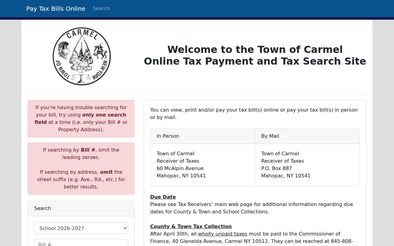
The screen's suffix and leading-zero instructions are useful because a failed address search can be a formatting issue rather than a missing parcel.
Note: The newer county property route points to Beacon, but its deeper field set was not verified in the official material reviewed.
Browse a Carmel Street in GIS
Putnam County's GIS resources document parcel boundaries and parcel data, sales, address and road layers, aerials, water features, and municipal, fire, EMS, school, township, village, and voter-precinct boundaries. The E-Parcel instructions call for a Tax ID search, a selected parcel outlined in red, and review of the information box for municipality, acreage, and address. Record the active layer, legend, basemap, and map date. Those details make a later parcel comparison reproducible.
Putnam County GIS downloads and layer information identify the parcel and district resources that support a by-address street review.
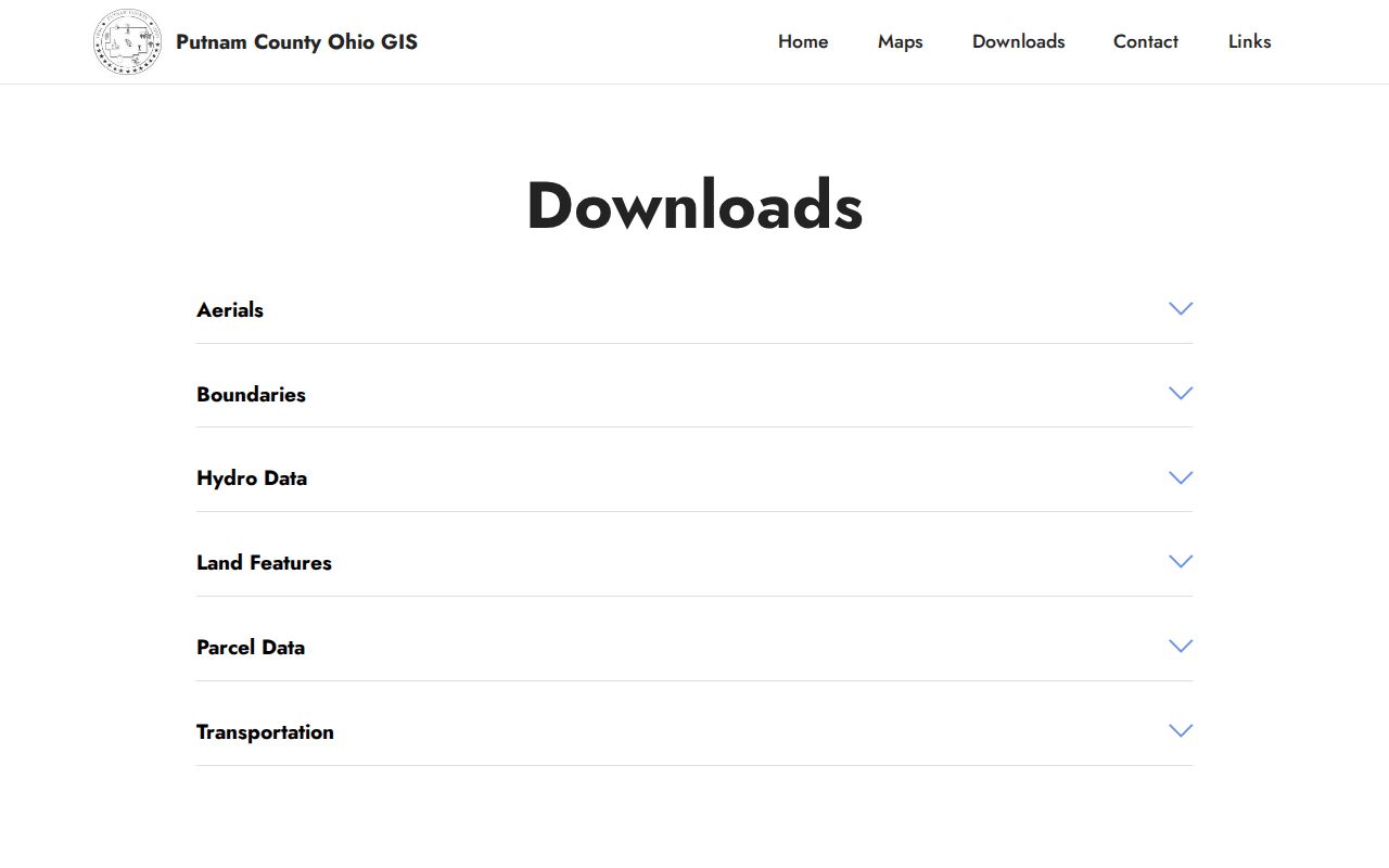
The map is a geometry and context source, not an owner roster. Take its parcel ID back to the tax record, then use the Clerk's land record for the recorded instrument.
The live materials did not verify a current buffer, radius, or automatic adjacent-parcel control. When those tools are unavailable, zoom to the street, click each visible parcel manually, and label the method as manual.
Carmel Street Records by Address
Each source answers a narrower question than a general street directory search. A tax bill is dated financial and parcel evidence. A deed is a recorded legal instrument. A building file may identify an applicant, agent, or owner at the time of a project. The table shows why a street-by-street result needs a source label instead of one unqualified name.
| Address record | Custodian | What the record can show | Access route |
|---|---|---|---|
| Town tax bill | Carmel Receiver of Taxes | Bill, map, property location, municipality, owner or mailing name, class, school, values, and tax lines | Public portal or dated print view |
| County assessment roll | Putnam Real Property Tax Service Agency | Parcel, owner/address, class, school, acreage or grid, assessment, exemptions, and taxable values | Roll, search, or counter; select the year |
| GIS parcel | Putnam County GIS | Geometry, parcel ID, acreage, address, and dated public layers | Map and data resources; live controls partly unverified |
| Deed or index | Putnam County Clerk | Grantor, grantee, instrument, date, legal description, and recording reference | SearchIQS guest route or record-room counter |
| Building and code file | Carmel Building Department | Applications, permits, certificates, inspections, notices, or orders | Address-specific department request; no public index located |
| Election record | New York and Putnam Board of Elections | Limited lawful name, residence, and district material, plus a self-status check | Self-lookup or restricted request |
| Historical printed source | Historian, libraries, or museum | Printed occupant, business, or address in the source year | Reference request; exact local reverse run is unverified |
A parcel number connects the tax roll, map, permits, and recorded land material more reliably than a road name. A street name still matters, but it can appear with a different postal city or an older form in historical sources.
Trace Carmel Street Deeds
After the parcel is pinned down, the County Clerk land-record route supplies the ownership trail. SearchIQS is the county-linked guest-search landing page, but the inspected landing state only verified guest access, account creation, login, and subscription controls. Its deeper field list and exact historical cutoff were not confirmed. For a record that does not appear online, use the Clerk's record-room research and copy appointment process rather than assuming the property has no earlier deed.
The county property's documented search help is a useful companion when a parcel, owner, property address, or billing address needs to be reconciled before the land-record search.
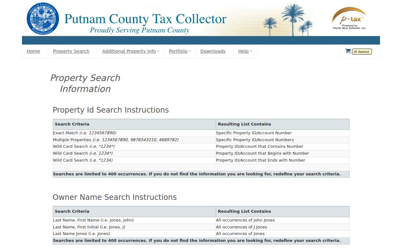
Save the instrument or book-page reference, recording date, grantor, grantee, legal description, and the source URL with each result. The current tax owner is not necessarily the person associated with the address in an earlier year.
- Parcel
- A piece of land identified by a tax-map or parcel reference. It connects a map view to a dated tax roll.
- Situs address
- The physical property location used for the parcel. It can differ from the owner's mailing address.
- Plat
- A filed subdivision or survey map that can connect lots, roads, and parcel references to a legal description.
- Criss-cross directory
- A printed reverse directory that may organize an address before a name or business. No complete Carmel run was verified, so confirm holdings with a repository.
Carmel Street District Overlays
Parcel and road layers can be compared with election, school, fire, EMS, and postal geography, but none of those boundaries proves that someone is present at an address. Carmel is a town, while Carmel and Mahopac are common postal labels. The official election map shows Districts 1 through 30, and the GIS resources document several public district layers. Date the map and layer because districts and polling locations can change.
New York's voter lookup asks for county, last name, first name, date of birth, ZIP Code, and address for a registration-status and polling-place check. It is not a street directory or a bulk street search. Election Law Section 3-220 and Section 5-602 set public-record and list rules; protected identifiers and confidential voter records are excluded.
A request for a voter file must follow the state Board of Elections process and its elections-purpose requirement. The Address Confidentiality Program and Election Law Section 5-508 require special handling of protected addresses.
Carmel Street Permits and Code Files
Town Code Chapter 59 identifies permanent Building Inspector records such as applications, permits, certificates, inspections, notices, and orders. Zoning-enforcement material also identifies complaints and enforcement actions. These are address-keyed property records, not a substitute for a current household listing. An applicant can be an owner, agent, architect, or contractor, so retain the document date, role, status, and disposition before drawing a conclusion from a name.
No public Carmel permit index was located. A focused request to the Building Department should give the street address or tax map, an approximate date range, and the exact record type sought, such as an application, issued permit, certificate, inspection result, order, or final disposition. The Town Code Chapter 59 text is the documented basis for the records category; the department can explain inspection and copy conditions.
Note: Keep a permit or complaint separate from its final status, because an address entry alone does not describe the outcome.
Carmel Street Directory History
For a historic road question, ask for a source that prints the address, year, page, and abbreviation key. The verified local leads are the Putnam County Directory for 1938-39 and the 1931 Putnam County Year Book. Exact local criss-cross or reverse-directory runs were not located in the inspected sources. The County Historian, Reed Memorial Library, Mahopac Public Library, and Putnam History Museum are the appropriate places to ask for reverse, telephone, business, and street-directory holdings.
The historical volumes themselves are described in the Carmel city directory collection route. Pair a printed road entry with its publication year and a historical map or deed description, especially when a number appears to have changed. No official Carmel road-renumbering or road-renaming bridge table was located, so treat a name match as a lead that needs corroboration.
Request a Missing Carmel Street Record
Online records are not the complete record set. Use the town tax portal for an available bill, the county roll and GIS resources for parcel context, and the County Clerk route for recorded instruments. When a building or older address file is not searchable, give the custodian a narrow request: address or tax map, date span, record type, and the desired fields or documents. That makes it possible to locate the right box, roll page, permit folder, or instrument without asking the office to infer a broad street-wide search.
The County Clerk FOIL form asks for the county department, a specific record description, a preferred electronic format, and requester contact information. For municipal building files, use the town department first and ask whether any part is subject to separate inspection or copying limits. New York Freedom of Information Law, Public Officers Law Article 6, does not remove restrictions created by a more specific confidentiality rule.
Carmel Street Directory Boundaries
A street record chain cannot identify every person connected with a location. It can omit non-owner household members, guests, delivery recipients, protected voters, and people whose address is protected through a state program. Motor-vehicle address information is restricted by the federal Driver's Privacy Protection Act. A mailing address can be outside the parcel, a tax roll can be annual, and an old deed can describe land without today's number. Treat each source as dated evidence, not as a universal list of current Carmel residents.
Lawful use. Carmel address records are for personal, lawful research such as family history, estate work, a property question, or public-agency context. Do not use an address-derived record to stalk, harass, intimidate, or harm anyone.