
Carmel Previous Residents by Era
One address leaves different kinds of evidence over time. A town bill and county roll are dated parcel records, not full household lists. Aerials and maps show physical or geographic context. Deeds identify recorded transfers and legal descriptions. Directories, newspapers, and census material can place a name or household in a particular source year. Start with the era that has the strongest address evidence, then bridge to the next source with the tax map, legal description, road name, map landmark, or adjacent parcel.
| Source | Years it covers | Where held | What it shows |
|---|---|---|---|
| Town tax bills | 2025 sample inspected; earlier and current retention depends on the portal | Carmel tax portal and Receiver of Taxes | Bill, tax map, owner or mailing name, situs, class, school, values, and tax lines |
| Putnam assessment rolls | 2024, 2025, 2026, and prior links visible | Real Property Tax Service Agency and PDF rolls | Annual owner/address/class/assessment/exemption and district fields |
| County GIS aerials | 1939, 1949, 1963, 1969, 1975, 1982, 1987, 1993, 1995, 1999, 2006, 2010, 2012, 2014, 2016, 2018, 2021 | Putnam County GIS | Parcel, road, water, district, and dated aerial context |
| County deed/index | Exact online cutoff not verified; archive history begins in 1812 | County Clerk, SearchIQS, counter, and archive finding aid | Recorded ownership, instruments, and legal descriptions |
| Putnam County Directory | 1938-39 | NYGenWeb lead; confirm a library or historian copy | Printed name, address, business, or community entry if present |
| Putnam County Year Book | 1931 | New York Heritage and local historical collections | Historical names, officials, town material, and maps |
| Federal census | 1790-1930 local microfilm; later releases follow the 72-year rule; 1890 was destroyed | Historian, libraries, and federal collections | Household and residence context on enumeration day |
The deed coverage gap is real: an official source did not supply the SearchIQS online start year or complete historical image coverage. If a transfer is not found online, move to the County Clerk record-room route and the County Historian's catalog rather than filling the gap with an unsupported date.
Carmel Previous Residents Start with Parcels
Fix the physical property before searching a surname. The current town bill and county assessment material distinguish the property location from a mailing address. The county GIS instructions add a parcel outline, municipality, acreage, address, layers, and map context. Capture the roll year, tax-map identifier, property location, current owner as printed, and legal description. That small record set is the anchor for a backward address trail, particularly where a Mahopac mailing label appears within the Town of Carmel.
Parcel and situs → current roll year → legal description → recorded instrument → prior parcel evidence. Each arrow is a check, not proof by itself. A tax record identifies a role on a dated roll. It does not establish that every person linked to the address was present there.
Use the Carmel tax search for a bill, tax map, or property address, and use the Putnam County real-property route for county rolls and parcel guidance. The town search tells users to omit a street suffix, while the county's older documented search allows partial and wildcard forms.
Carmel Previous Residents in Tax Rolls
Tax material is the best way to establish a dated starting point, but it has a narrow role. The inspected Carmel sample is a 2025 Town and County bill. It displays bill and account information, a tax-map number, property location, municipality, class, school, value and assessment fields, owner names, a mailing address, and itemized tax lines. Those are useful fields to preserve individually. They should not be collapsed into a claim that the owner, bill recipient, and past household were the same person.
The county roll format can add parcel placement, owner/address as printed, location, class, school district, acreage or grid, values, exemptions, special districts, account number, deed book/page when shown, and the roll year/page. Carry the year and page with an extracted entry. A later tax roll can show a different name without explaining when or how the change occurred; the deed chain supplies that recorded transition.
Note: A tax bill is a dated financial and parcel record, so use its own year rather than treating it as a timeless address history.
Carmel Previous Residents and the Deed Chain
The Putnam County Clerk holds or routes recorded land instruments and directs users to the SearchIQS guest portal. Its inspected landing state confirms guest access and account controls, but the exact online cutoff and deep search fields were not confirmed. Use the portal as a starting point, then use the Clerk's counter and record-room appointment route for an earlier instrument or a field that is not visible online. The legal description is the continuity key when a road name, house number, or postal label shifts.
- Match the current Carmel tax-map and situs record to the correct roll year, then copy the legal description and owner as printed.
- Search the current owner as the grantee in the County Clerk land-record route and locate the purchase instrument or its recording reference.
- Read the seller, who is the grantor in that conveyance, along with the recording date, instrument or book-page number, legal description, acreage, and map reference.
- Search that seller as a prior grantee to locate the earlier acquisition, checking initials, estate names, corporate names, and spelling variants.
- Repeat the handoff backward. When the legal description changes, compare filed maps, lot references, road or water landmarks, and adjoining parcels.
- For a missing online period, request the identified instrument at the County Clerk counter or ask the County Historian for a relevant collection citation.
- Grantor
- The party transferring an interest in the recorded instrument. In a typical sale, this is the seller.
- Grantee
- The party receiving an interest in the recorded instrument. In a typical sale, this is the buyer whose earlier acquisition can lead farther back.
- Chain of title
- The sequence of recorded transfers used to test how the same property moved from one recorded interest to another.
- Legal description
- The land description in a deed or map reference. It is often more durable than a street address when tracking an older Carmel property.
Carmel Previous Residents on Historic Maps
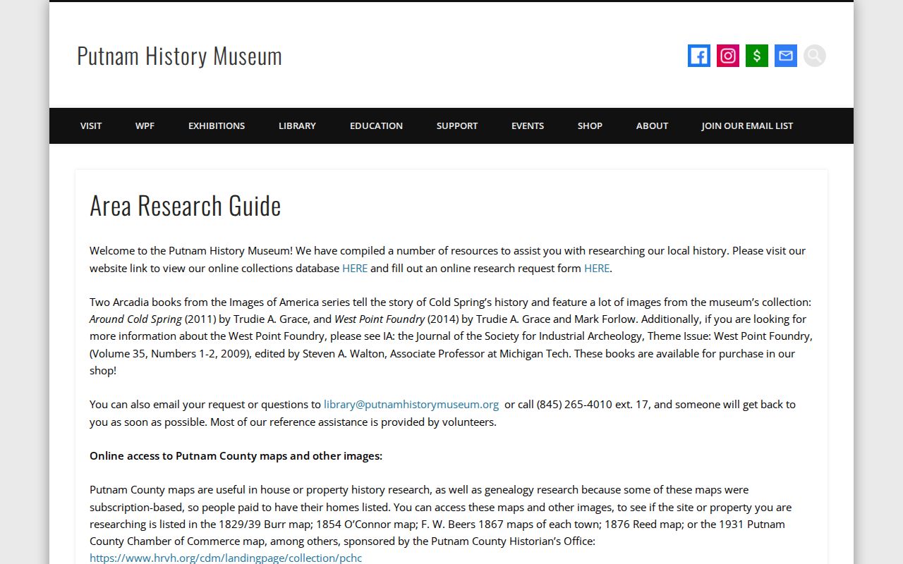
The strongest local house-history trail is deliberately mixed. The Putnam History Museum recommends starting with current ownership, moving backward through buyers and sellers, comparing the chain with maps, and then searching newspapers and local collections. Its route identifies Burr maps from 1829/39, O'Connor from 1854, Beers from 1867, Reed from 1876, and a Chamber of Commerce map from 1931. The Library of Congress also holds an 1848/49 Putnam County map record. A map can place a road, water feature, farm, or owner label at its own date, but it is not a current address list.
The Putnam History Museum area research guide provides the local map, newspaper, and deed-chain route for a Carmel property question.
Comparing several dated maps is more useful than forcing an old road or hamlet name into a modern street number. No official Carmel road-renumbering or road-renaming bridge table was located.
Carmel Previous Residents in Directories
Recorded ownership is only one layer of an address history. For a past household connection, pair the property trail with a dated directory, newspaper, or census source. The verified local lead is the 1938-39 Putnam County Directory, although a complete online scan and confirmed physical copy location were not located. The digitized 1931 Putnam County Year Book is a separate town and community source. Ask for the exact printed entry, year, page, collection name, and abbreviation key, not a conclusion based on a bare name.
The collections themselves belong with the Carmel city directory sources. For an address-history question, the useful handoff is the date: a directory or newspaper supplies a time-and-place lead, and the deed or roll shows whether the property record aligns with it.
- Choose a directory, newspaper, or map date close to the address period being tested.
- Search the surname, street or hamlet form, and the Carmel or Mahopac postal label used in that source.
- Compare the result with the nearest available census year, keeping the enumeration date and district context.
- Use the tax map, legal description, and deed chain to decide whether two address forms refer to the same parcel.
Carmel Previous Residents in Census Trails
The County Historian's materials include Putnam federal census microfilm from 1790 through 1930, New York State census material for 1915 and 1925, and a broad collection of newspapers, maps, cemetery material, church records, family files, and indexes. The federal 1890 schedules were destroyed, so no substitute should be promised. Recent federal schedules are released under the 72-year rule. Use a census record to place a household on its enumeration day, not as proof of every address or relationship across a decade.
Newspaper runs can fill a narrow date gap. The Historian collection identifies the Putnam County Courier from 1851-1972 with gaps, the Putnam County Republican from 1882-1946 with gaps, and the Putnam County News and Recorder from 1950-1999. An obituary, sale notice, civic item, or legal notice remains a dated publication claim. Preserve the title, issue date, page, and repository before connecting it to a property.
Putnam County Historian and Archives is the reference route for local census, newspaper, map, and archival collections. Confirm its access arrangements before traveling.
Carmel Previous Residents and Building Dates
Building and code files can date changes at a parcel when a deed chain alone does not explain them. Town Code Chapter 59 identifies applications, permits, certificates, inspections, notices, and orders as Building Inspector records. Zoning-enforcement materials identify complaints and enforcement actions. A document may include property, date, proposed use, valuation, nature of a project, and a named role. It must be read as property or code history, not as a conclusion about every person connected with the address.
No public searchable Carmel permit index was located. Request the records by street address or tax map, approximate date, and record type. Ask for applications, issued permits, certificates of occupancy or compliance, inspection results, violations, complaints, plans, or final dispositions only as needed. The custodian can identify inspection, copying, redaction, and plan-handling limits. County GIS aerials, assessments, permits, maps, and newspapers can then be compared as separate dated layers.
Carmel Previous Residents at Trail Endpoints
An obituary, cemetery record, funeral notice, or Surrogate case can close a period in a house history and point to an estate, fiduciary, heir, or later place. It does not turn the full chain into one continuous household. A later grantee may be an estate, surviving co-owner, trust, or purchaser. Reconcile the document date, party role, legal description, and the underlying probate or court file before treating the name as a past address connection.
For a Putnam matter, use the court or Clerk route with a case number, party name, approximate date, and case type, and ask about public inspection and copy conditions. Court records can be sealed or otherwise restricted. A no-result search should be described as not found in that system, rather than proof that no case existed.
Note: An obituary or probate lead can mark a transition, but the dated instrument and underlying file remain the stronger records for the parcel trail.
Carmel Previous Residents and Missing Files
When the address trail breaks, make the request as specific as the property record allows. The County Clerk's online FOIL form asks for the county department, a specific record description, a choice about electronic format, and requester contact information. For a missing land record, identify the instrument reference, book/page, names as indexed, municipality, and approximate recording date. For an older building or archive file, provide the street form, tax map, date range, and collection or record type. The correct response to an unverified coverage gap is a custodian request, not a guess.
The Putnam County Clerk FOIL request form shows the structured route for a narrowly described county record request.

The form supports a record-focused inquiry. Keep the request limited to public material and retain any fee notice, redaction, delay, or custodian referral with the research notes.
Carmel Previous Residents Have Limits
Past-address research cannot identify every person connected with a property. Non-owner household members, guests, protected voters, and people using an address-confidentiality program may be absent from the record trail. A historical directory can use an old postal place or number. A tax map may prove parcel continuity without naming a past household. Preserve uncertainty when the sources do not align, and do not publish protected address information or unnecessary personal details from a record.
Lawful use. Use Carmel house-history and previous-resident records for personal, lawful research, family history, estate questions, or property context. Do not use a dated address trail to stalk, harass, intimidate, or harm any living person.